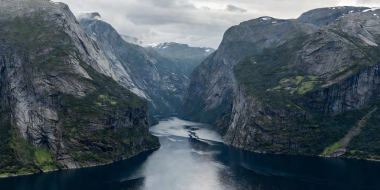
Geirangerfjord
A 15-kilometer branch of the Storfjord system characterized by exceptionally tight S-curves, dramatic waterfall walls (Friaren and The Seven Sisters), and sheer rock cliffs climbing 1,400 meters above sea level.
Norway’s fjords are not peaceful river valleys; they are violent tectonic and glacial gouges where ice sheets miles thick sheared metamorphic bedrock down to seafloor depths.
These drowned canyons extend over 200 kilometers inland from the Atlantic coastline, cradling brackish surface water under massive granite walls. Understanding their scale requires examining both what rises toward the clouds and what descends beneath the water line.
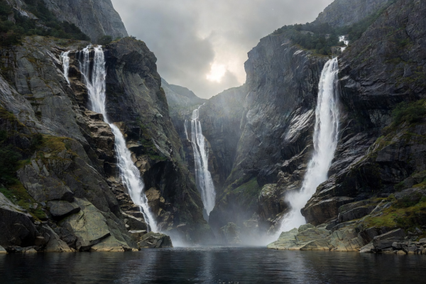
A 15-kilometer branch of the Storfjord system characterized by exceptionally tight S-curves, dramatic waterfall walls (Friaren and The Seven Sisters), and sheer rock cliffs climbing 1,400 meters above sea level.
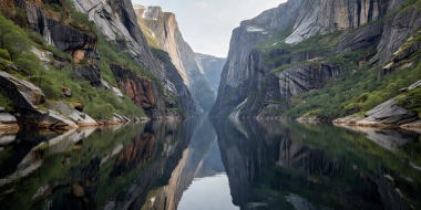
Only 250 meters wide at its narrowest channel, with precipitous canyon walls that block sunlight from touching the water for months during winter. It represents the quintessential dramatic narrow fjord.
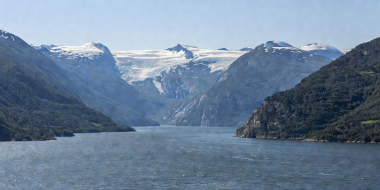
The second-longest fjord in Norway, serving as the dramatic western drainage for the immense Hardangervidda mountain plateau, lined with lush fruit orchards and steep glacier arms like Folgefonna.
A critical geological characteristic that distinguishes a true fjord from a normal marine inlet is the terminal moraine sill (terskel). As ancient glaciers advanced toward the outer coast, their buoyancy increased as they reached deeper ocean waters, reducing their abrasive grinding power.
Consequently, the inner sections of Sognefjord plunge to depths exceeding 1,308 meters, while the seaward mouth near the ocean rises to a submerged threshold of merely 100 meters deep. This sill creates a sheltered inland basin where saltwater remains calm, protected from severe Atlantic wave swells.
Despite almost unnavigable terrain, historical Norwegians carved out sustainable pastoral communities high above the water. At sites like Skageflå and Knivsflå in Geirangerfjord, historic farmsteads cling to tiny shelves hundreds of meters above the waterline, accessible only via ladders carved into rock or treacherous switchback footpaths.